SSE Stock Code:603019

You can also follow the Sugon WeChat official account
Scan with WeChat to log in. Access materials more easily.

January 2025
Service Hotline:400-810-0466
Live Support, Online Repair, Warranty Inquiry, Device Binding, Complaints

Helps key basins understand water pollution status, capacity, trends, sources, and treatment results.

On top of the pollution-equivalent method, consider a point source’s harm to water sources and socioeconomic benefit for more comprehensive evaluation

Use multiple numerical models for key areas; group pollution-control measures by scenario and support multi-scenario visual comparison

Multi-level system design with parameter libraries and emergency-handling technical databases, supporting information and business interaction among levels
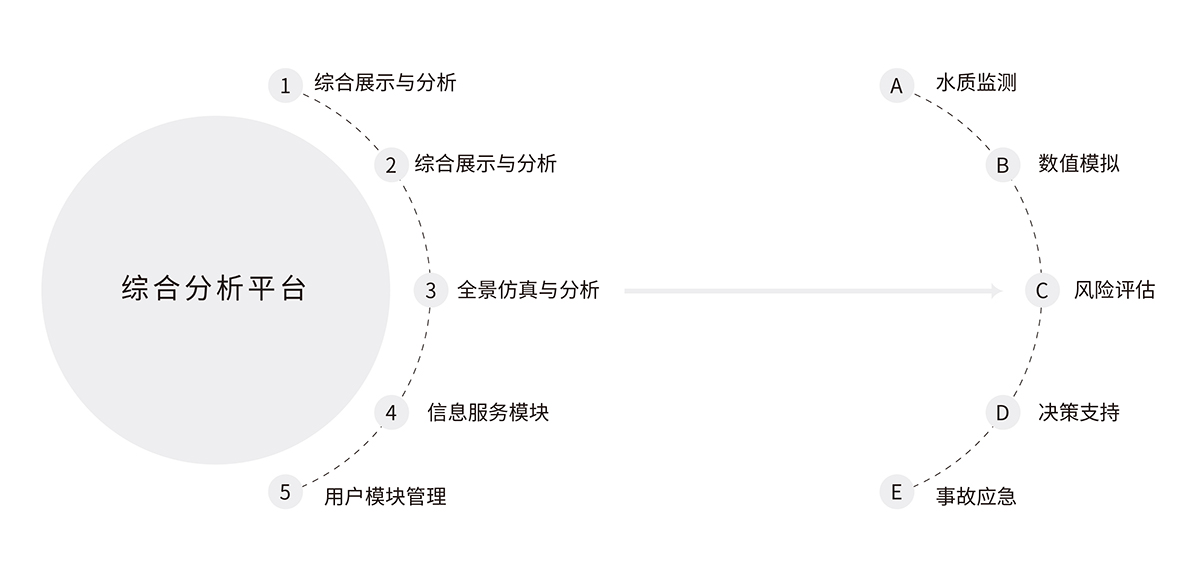
Water-environment quality forecast and warning system:Based on water-environment numerical models, build water-environment quality forecast systems for basins, rivers, lakes/reservoirs, and bays, providing forecast products for dissolved oxygen, ammonia nitrogen, total phosphorus, total nitrogen, heavy metals, algae, and more for a future period; based on monitored and forecast water-quality data, warn on large water-quality changes exceeding standards, abnormal trend changes, and drinking-water-source water-quality risks over a given period.
Water-environment pollution-source assessment system:Water-environment pollution-source assessment includes point-source and nonpoint-source assessment. Point-source assessment comprehensively evaluates point sources quantitatively considering emission characteristics and amounts, and displays them on a map; nonpoint-source assessment uses numerical models to estimate river loads of nitrogen, phosphorus, heavy metals, and more, identifying key source areas and high-risk areas of nonpoint-source pollution.
Water-environment quality decision-support system:Compare current water quality and forecast results with water-quality planning targets, combine pollution-source inventories to assess water-quality improvement from pollution-control measures, and support scientifically formulating pollution-load reduction and spatial-allocation plans.
Sudden water-pollution-accident emergency simulation system:Can simulate pollutant migration and transformation based on accident location, pollutant type, leak amount, leak mode, meteorological and hydrological conditions, and more, calculating pollutant concentration distribution, time for pollutants to reach important downstream sections, and duration and spatial distribution of pollution belts exceeding specified thresholds.
River/sea outfall information-management system:Implement unified, standardized information management of river/sea outfalls, build an outfall “one map,” grasp existing outfall counts, distribution, changes, discharge status, and management status, and build an IT management platform for river and sea outfalls, providing management support to connect “shore and water” and “land and sea,” do a good job of water-pollution prevention, and improve water-environment quality.
Includes early-warning/forecast, pollution-assessment, and decision-support applications, and is compatible with mainstream industry model software.
A comprehensive visualization system presents the current water-environment status in the jurisdiction in real time, with multiple mechanisms assisting fast, precise decisions.
A mature, reliable methodology combining multiple methods to ensure evaluations are scientific, timely, and accurate.





 +86 400-810-0466
 international@sugon.com
 津公网安备 12011602000521号
+86 400-810-0466
international@sugon.com
津公网安备 12011602000521号
津公网安备 12011602000521号
+86 400-810-0466
international@sugon.com
津公网安备 12011602000521号


 Register /